


8. If you want a satellite image instead of a map of the same region, just select the "see orthoimages..." option.
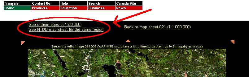
Orthoimages are composites created from Landsat imagery of the exact same areas covered by a given mapsheet. They provide a much more up-to-date look at roads and land features.
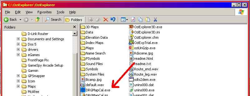
9. Lets calibrate our new downloaded image so OziExplorer can use it. Go to the folder where you placed DRGMapCal and start the program. It may be a good idea to create a desktop shortcut to this file.
Select the "Toporama" option once you pass the main screen. On the "Input" box select the "1:50000" option and browse to the directory where you placed the downloaded image. On the "Output" box browse to your "Maps" folder on your OziExplorer folder. Then press the "Generate map calibration files" button.
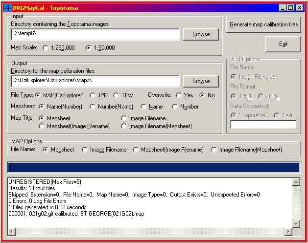
Once the file is generated you'll see a text-box showing if the file was created properly. If all goes well, you'll see something like the above. Please note that you can generate multiple MAP files if you have more than one image in your "Input" directory. The shareware version of DRGMapCal will calibrate 5 images at once. IMPORTANT: The original GIF file you downloaded from Toporama MUST be placed in the OziExplorer "Maps" directory after you generate the calibration. Otherwise OziExplorer won't have a picture to display.